해양공간정보를 활용한 LSTM-CNN 기반 어선 해양사고 위험 예측모형 개발
Development of an LSTM-CNN-Based Risk Prediction Model for Fishing Vessel Maritime Accidents Using Marine Geospatial Data

- 강다현, 박재형, 하준성
- 공간정보공학과
- 2026년 05월 24일
- #LSTM-CNN #딥러닝 #해양공간정보 #해양사고
- @v2earts @zh._.hyeong @jundong2_
시공간 데이터로 예측하는 어선 해양사고 위험 해역
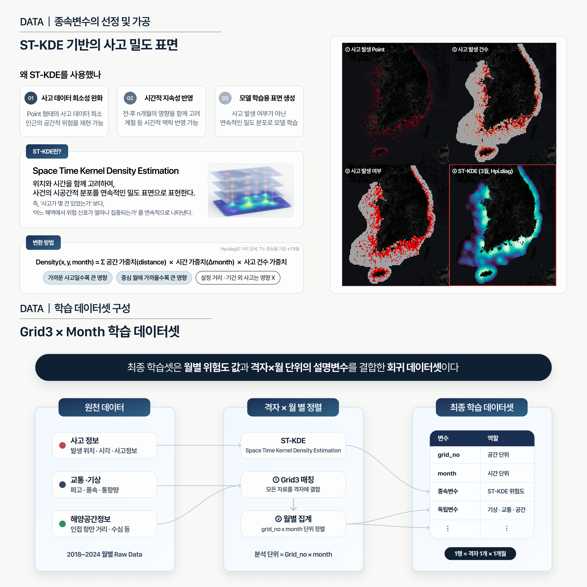
해양사고 데이터를 ST-KDE 기반 위험도 표면으로 변환하여 종속변수로 활용하고,
해양교통·기상 데이터, 해양공간정보를 설명변수로 사용하였다.
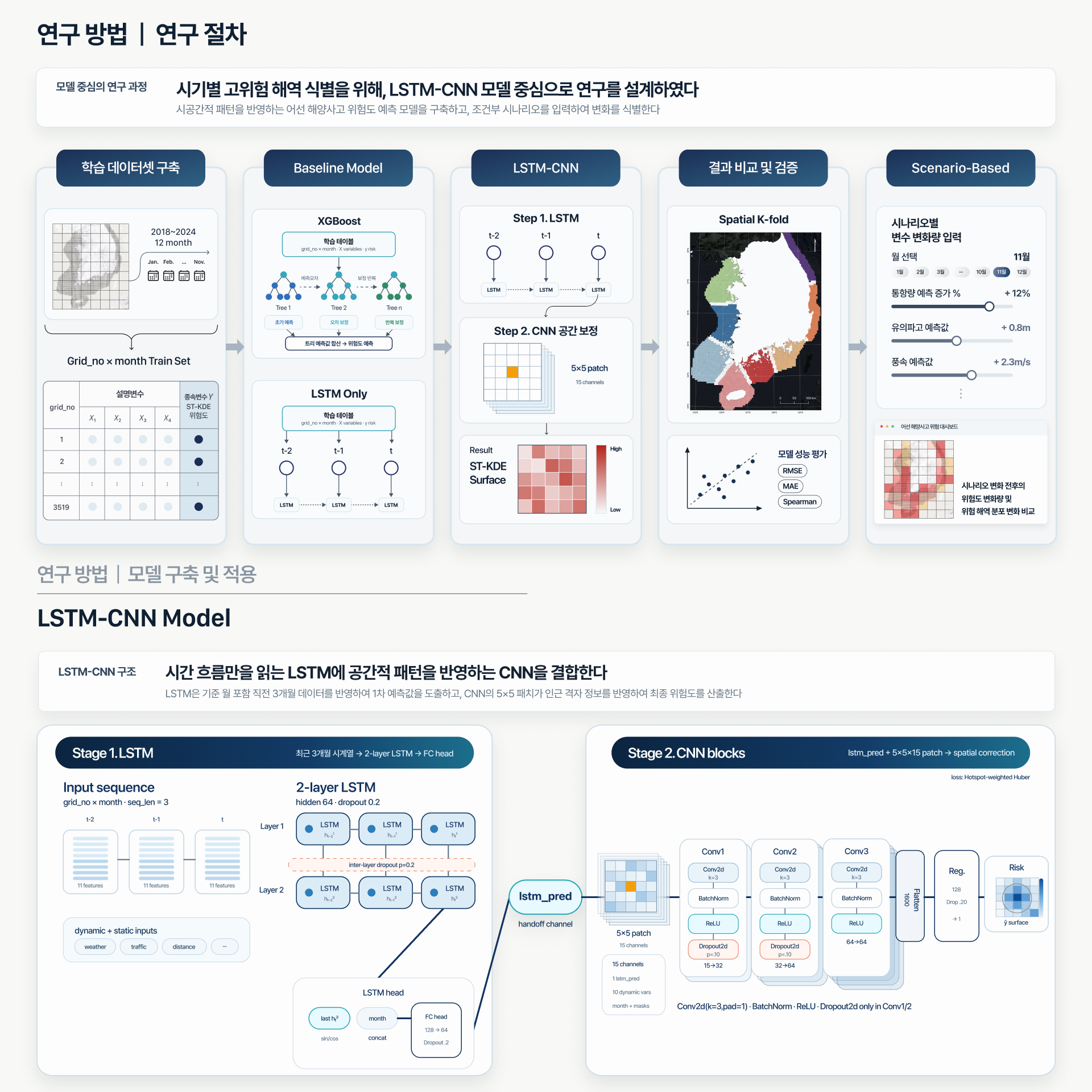
모델 학습에는 위 변수를 격자·월 단위로 결합하여 만든 데이터셋을 사용하였다.
XGBoost, LSTM 대비 모든 지표에서 개선된 성능을 확인할 수 있었으며, 최대 95.6%의 Hotspot 재현율을 기록하였다.
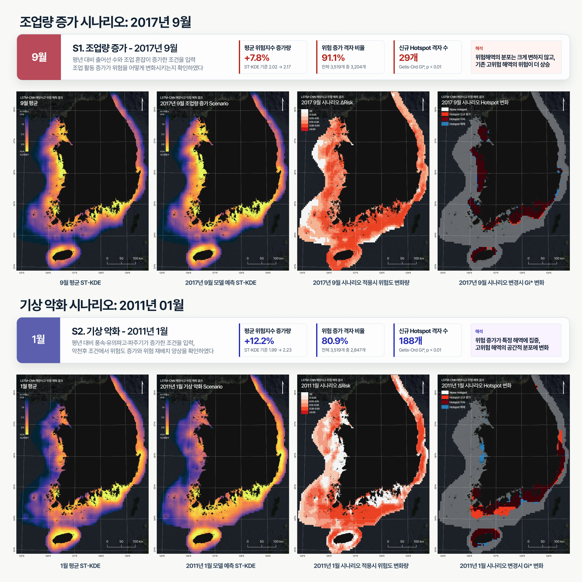
시나리오에 따른 위험 변화를 확인하였고,
웹 대시보드에서 사용자가 조건을 입력하면 위험도 변화를 확인할 수 있도록 하였다.
월별 어선 안전관리 정책·실무 의사결정을 보조할 수 있을 것으로 기대한다.
This project develops an LSTM-CNN-based deep learning model for predicting high-risk areas of fishing vessel maritime accidents.
Marine accident records were transformed into risk surfaces using Spatiotemporal Kernel Density Estimation, or ST-KDE, and used as the target variable. Marine traffic data, meteorological data, and marine geospatial information were used as explanatory features.
For model training, these variables were integrated into a grid- and month-level dataset.
The proposed model achieved improved performance across all evaluation metrics compared with XGBoost and standalone LSTM models, recording a maximum hotspot recall of 95.6%.
Scenario-based analysis was conducted to examine changes in accident risk under different conditions. In addition, a web dashboard was developed to allow users to input conditions and visualize corresponding changes in predicted risk levels.
The model is expected to support monthly safety management policies and operational decision-making for fishing vessels.
웹 대시보드의 경우, 배포시 서버 유지 관련 사유로 시연 영상으로 대체합니다.
문의: [email protected]